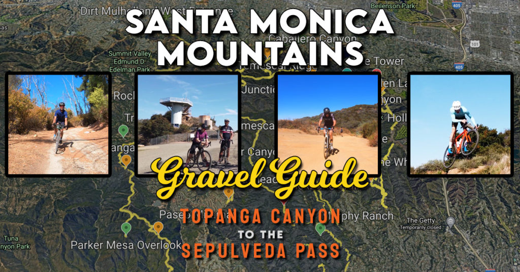
Make no mistake about it: there is no better place that’s more accessible in the Los Angeles area for dirt than the Santa Monica Mountains gravel.
While there are many possibilities throughout the county, the area bounded by Topanga Canyon and the Sepulveda Pass don’t only possess the most number of routes, but it’s well within reach from both the San Fernando Valley and the westside.
When people ask me where to go, I normally send them here because it offers something for all riders and if you’re up for more, there’s so many choices.
As with the problem with most gravel, it’s hard to be totally adventurous because getting into unrideable situations happens so much more on dirt than pavement, so I thought I’d come up with the ultimate guide in this video.
I wanted to give an overview of all the major trails, but also go above and beyond my other gravel guides to give context to give connectivity.
Consider this article a supplement with all the necessary links to find these trails while accompanied by my notes to help you gauge what’s in front of you.
The listing of trails and links come mostly from east to west, but they follow the order set in the video to follow along.
Enjoy…the dirt!
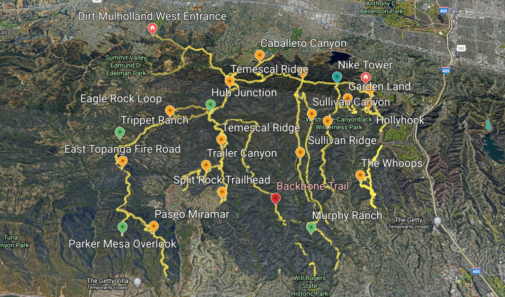
Dirt Mulholland
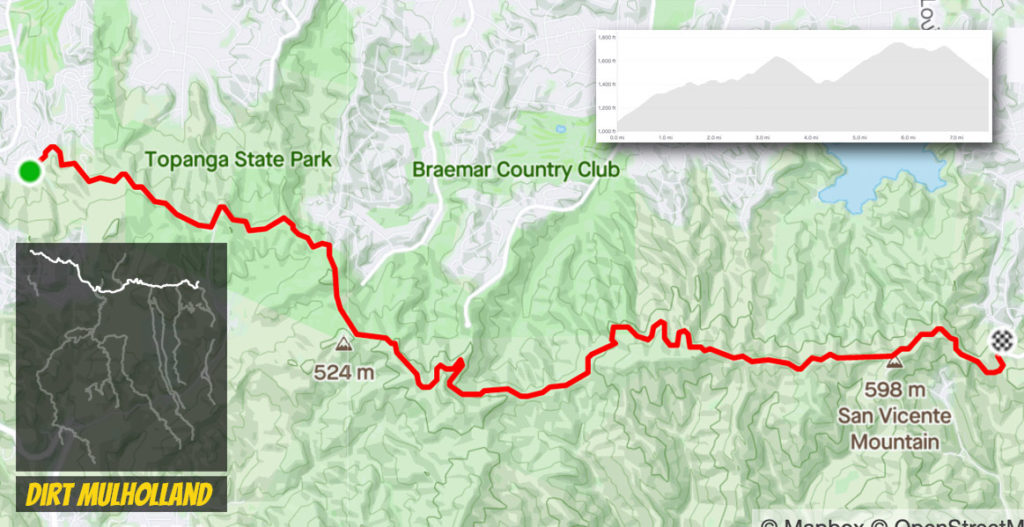
The spine connecting Topanga State Park through Encino, this is where I send many first timers for their introduction to dirt. While there are significant portions of climbing, the bookends are relatively tame and gives a good feel for what dirt is like. The conditions are choppier in the middle, but if you’ve made it that far you likely already have a handle for what you’re up against.
Upper Canyonback
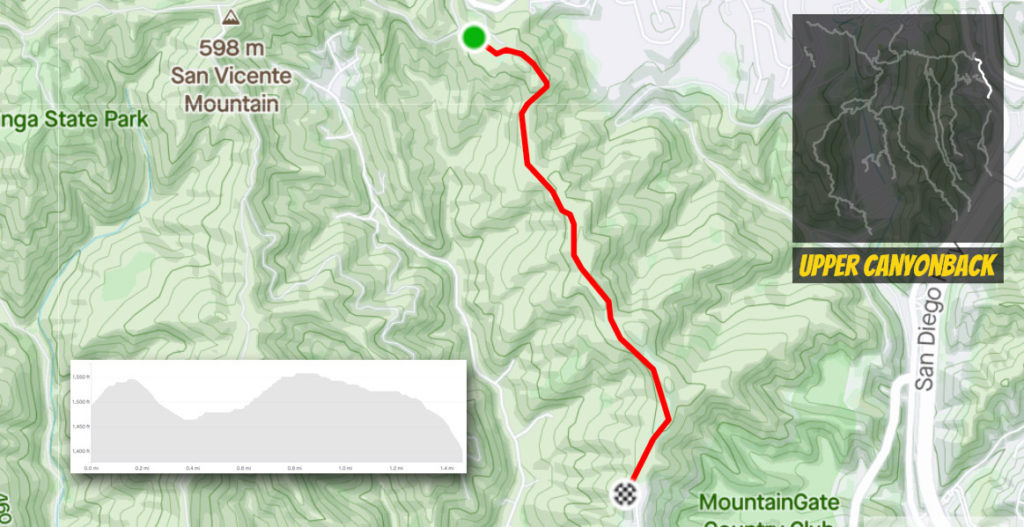
Just off the start on the eastern portion of Dirt Mulholland, this short stretch of dirt is filled with hikers connecting to the Mountain Gate community. The most difficult part is the climb coming out of the southern entrance, but is short enough to grit your teeth. There’s also water near the starting point by the tennis courts.
Lower Canyonback
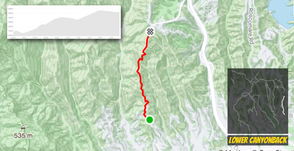
The average grade is a bit deceptive as the profile is like an unstable wave length with slopes in and out of the teens. While counting the pavement, it’s longer than the upper counterpart, but the southern end spits you out to Kenter which is a tough climb even on 25mms.
The “Whoops”
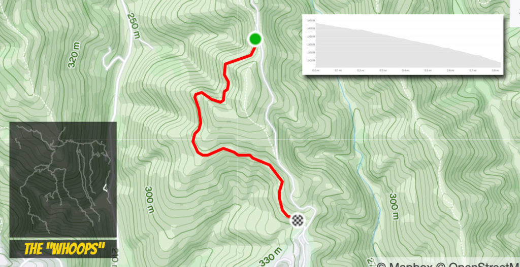
While shorter than a mile, easily the most stretch of dirt anywhere. Even for the novice, the humps can be taken at a slow pace building up confidence that reaches jumping speed. There’s a couple of spots where you could land in great peril, but following the heavy tracks will put you on the right path. Etiquette tells you to ride this path north to south (downhill), but looping back on Lower Canyonback makes you understand why you see e-bikes out here.
Hollyhock Trail
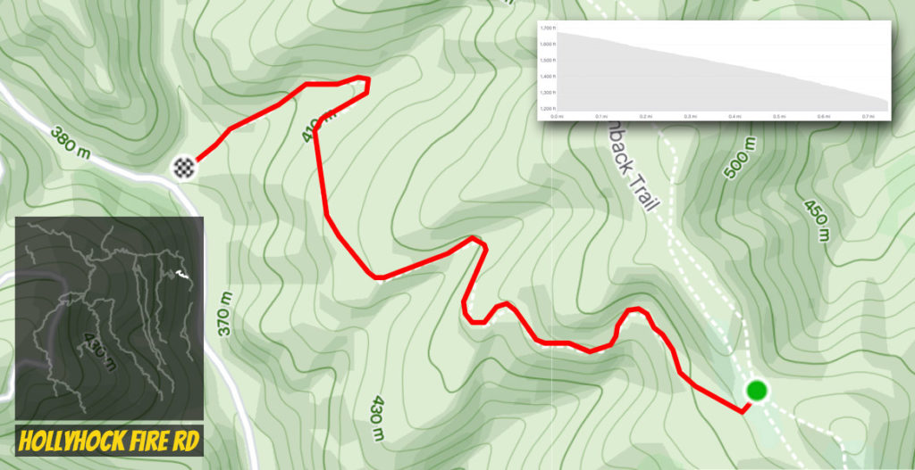
Another short connector that’s handy to head down to Mandeville Canyon or add variety. While averaging 11%, this fire road has been recently regraded and is in good condition meaning there’s a lot of integrity whether climbing or descending. At least the slope is consistent.
Garden Land Trail
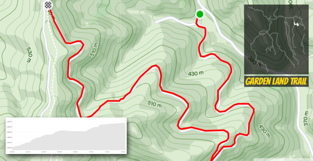
A tale of two climbs as the start is stiff while it dials back significantly towards the top. This road is mainly there to service the power lines, so make sure to veer right at the first turn. It’s a short, but efficient way to get to the heart of the trails and connects to Westridge.
Westridge
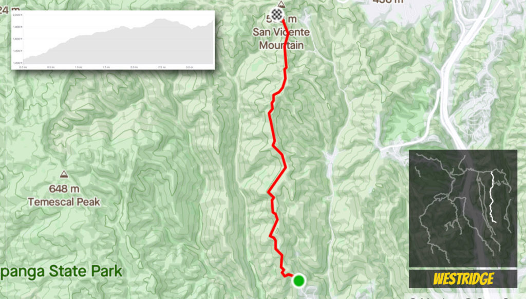
Westridge is where gravel gets real because it is the closest stretch of significant dirt accessible from the Westside. The slopes are mostly steady with a few dips built in, but the heaviest section is at the northern end where you come up on one of the area’s focal points, the Nike Tower.
Sullivan Canyon
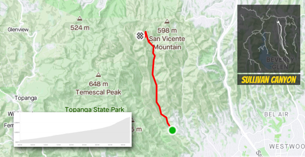
This is one of the few opportunities to ride deep in a canyon while easily the best. The tree cover makes this the most palatable climb during the summer as you’ll see a lot of hikers and bikers flocking to this shade. Stream crossings may occur at certain points of the year (beware getting caught in the concrete matts), but you’ll find the first three miles super fast as ascending to the north keeps a low grade. The climb crescendos the final mile with the last half kicking you at double digits.
Sullivan Ridge
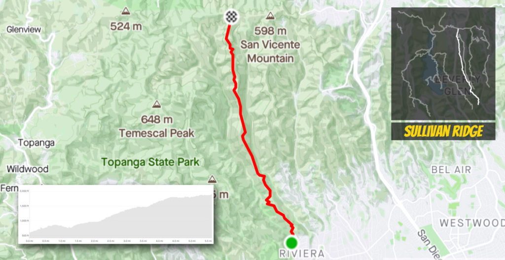
Sullivan Ridge is one of the longer closed roads out here, but the first couple of miles are mainly pavement. The dilapidated Nazi Camp known as Murphy Ranch sits below to the west on an offshoot a mile up. Once you go around the second gate, you are met with dirt and a hefty two mile climb which is followed by a steeper kilometer as the end flattens out where you connect with Sullivan Canyon and Dirt Mulholland.
Backbone Trail
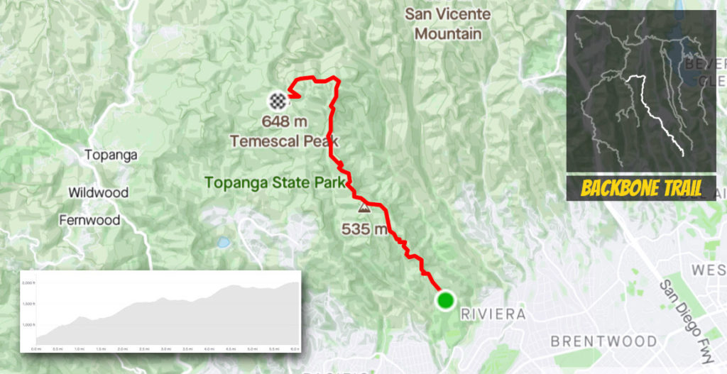
While rideable, I didn’t go into detail for the video because it can be super unpleasant. Mainly a single track climb, there are a couple of rocky hike a bike sections that even mountain bikes have difficulty negotiating. My biggest pet peeve is how overgrown the middle section can get with weeds growing up to eye level scratching you everywhere are you roll by. It’s a ride you won’t be looking to repeat soon…
Temescal Ridge
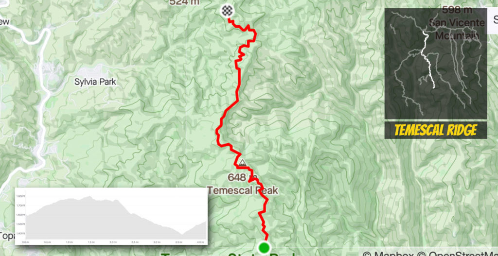
Temescal Ridge is a heavily used connection bridging Dirt Mulholland to Hub Junction and the two options off of the Eagle Rock Loop. Other than the steep climb near that intersection, Temescal rolls and stays safely in the single digits. On the southern end, it connects to the first segment of the Backbone Trail, while it terminates just short of the park with the Split Rock trail exiting you into the Pacific Palisades.
Trailer Canyon
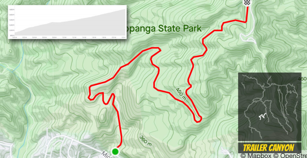
The other southern option to get up to Temescal Ridge is also the more popular one. At two miles, there’s a lot of gear grinding as you wind your way up, but the most difficult section is the start. Some of the grades on the street getting to the start are steeper than the trail itself.
Eagle Rock North
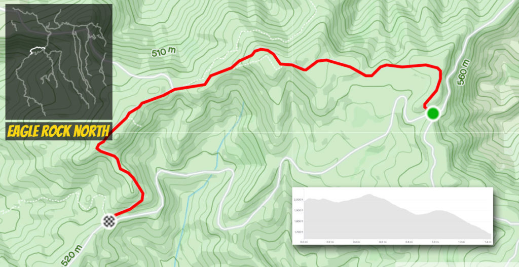
This is the tougher section of the two Eagle Rock choices as the western portion is rockier and steeper in stretches. The trade off are the great views above the crags, especially looking off towards Saddle Peak. This section also is designated as part of the Backbone Trail before it vears off at the western terminus.
Eagle Rock South
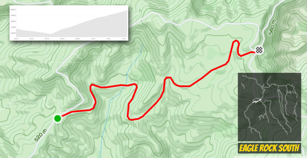
It’s not so strange that this section shares the same length and slope averages as its twin to the north, but it’s definitely the tamer of the two. The highlight is the prime view of Eagle Rock as you pass underneath it. Overall, this path is wider and has much better conditions, especially the hard, red sand on the east.
East Topanga Fire Road
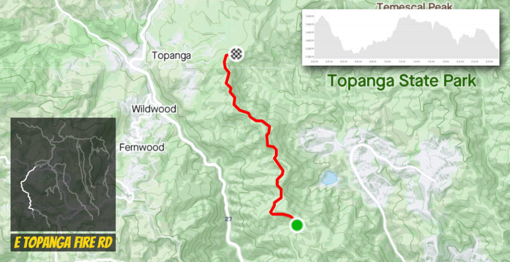
This road is a go between of nomenclature as it picks up on the west side of the Eagle Rock Loop as terminates at Paseo Miramar. The inconsistency of this route is often overlocked as there’s extreme climbing or descending going either direction. It also connects to Trippet Ranch with water and restrooms which also exits out to Topanga Canyon, but you’ll have a steep pitch getting there.
Paseo Miramar
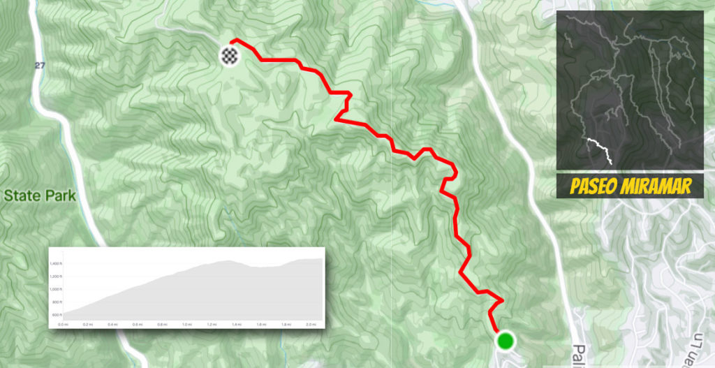
Paseo Miramar is by far the toughest effort in the hills. Even riding the pavement getting there is tough with a section over 20%. Hitting the dirt isn’t much easier as the climbing portion normally runs around 12%. Many hikers too, so it’s better to go up it rather than descend at high speeds through them.
Parker Mesa Overlook
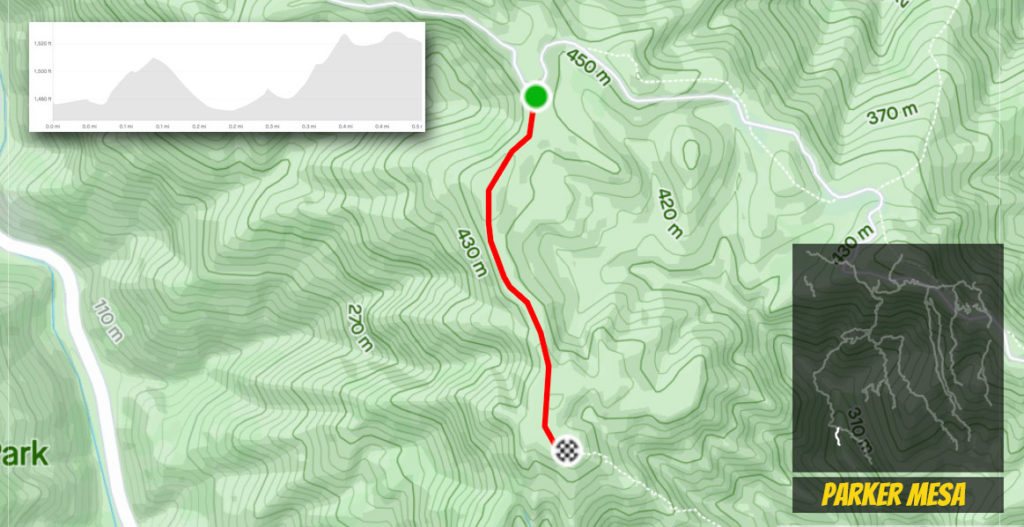
Less than a mile from the top of Paseo Miramar, many take this short diversion for one of the best views over the ocean. This is a dead end, but you will have to ramp up speed in a couple of spots to combat the rockiness that pops up.
Caballero Canyon
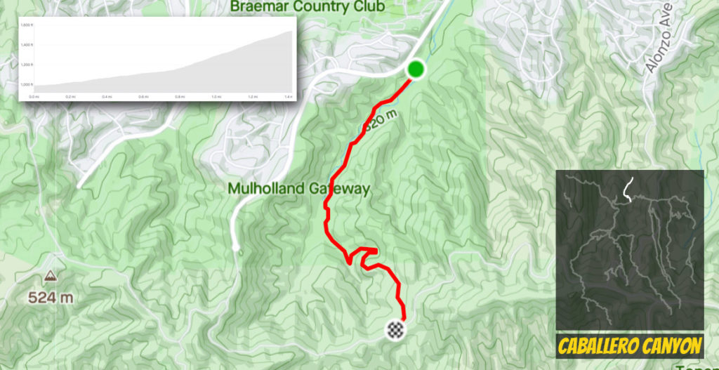
While there are a few short connections to Dirt Mulholland from the Valley side, this is by far the most established section of dirt. It’s technical for a good part and you likely will have to hike a bike in a couple of spots, but it’s a better choice for reaching dirt than the heavy paved climb up Reseda.
Viewridge Trail
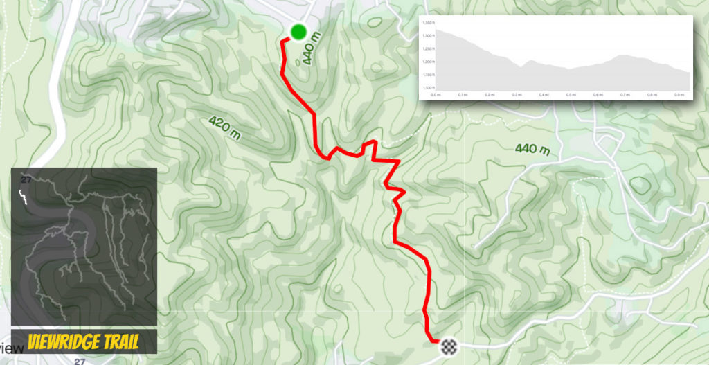
Just a short mile of dirt, this piece of single track is hidden from view, but provides some good fun. The trail does continue east, but bikes aren’t allowed on that section and the road it dead ends on is private.