A typical writing structure would grab you about what you’re missing out on, but I’ve done enough pieces about the Eastern Sierra that if you don’t get it by now, you may never get the spirit of adventure.
I love every trip out there because they are unique experiences that also feel fresh, so when I have the opportunity to try something new like biking Lake Sabrina, I’m out the door.
The ride itself is simple being an out and back up Highway 168, but most share the need for seeking more and finding out what options lay ahead.
Looking on Strava Heat Maps, there is some off-road usage which is still hard to judge with the potential of the Owens Valley being super soft and pummusy depending on the time of year.
Regardless of surface, my main mission was to catch fall colors at their peak and thank goodness there are plenty of resources to help track your timing.
Lake Sabrina looked to be in great form, even using Instagram to help verify, so even if we were only going out for 24 hours, I knew it would be worth it.
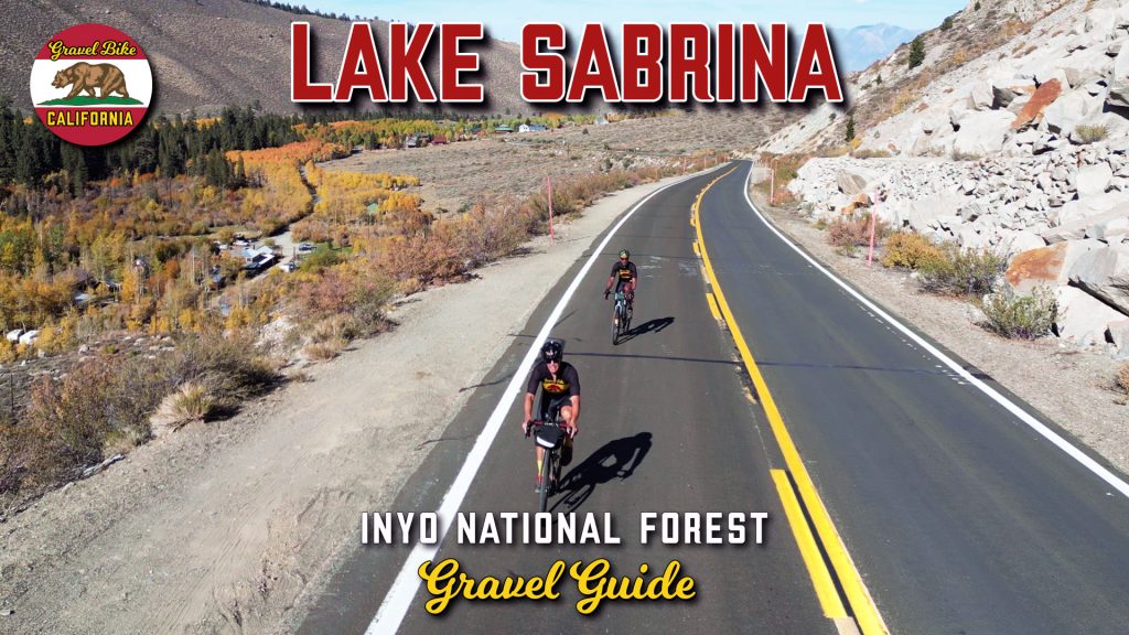
We started out of Bishop around noon as directions were simple heading west on Highway 168 for the duration.
It’s only a slight grade the first three miles, but the first bend to the left starts inching up the incline with the historical marker for the Owens Valley Indian War being the most noteworthy early on.
To the right lies the Buttermilk Boulder area which offers a few miles of off-road possibilities, but with the potential of deep softness, this is an adventure out there that might have taken more time.
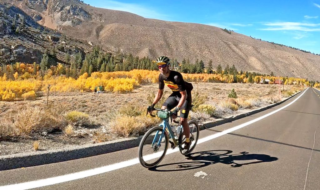
As we took an elongated one mile S-curve into the mountains, you get your first good look back into the Owens Valley as the rest of the climb quietly becomes more arduous dealing with the elevation and straightaways that hide the slope.
Nearing the fifteen mile mark, you start to see fall colors in the distance, as well as the turnoff to South Lake which is 2 1/2 miles and 600 feet of ascending more than biking Lake Sabrina.
Stay on Highway 168 will soon reward you, as the nearing Bishop Creek delivers fall colors at their peak with mid-October delivering the perfect hue.
Right past lies the community of Aspendell and if you’re in the need for food, the resort towards the bottom of Cardinal Road will quickly provide.
Highway 168 technically ends before Lake Sabrina and before that designation, but biggest regret was not doing the short mile and a half offshoot up to North Lake which would have been reason enough justifying wider tires for the day.
The last mile up biking Lake Sabrina gets pitchy in parts, but you’re closer to the foliage so speed doesn’t matter.
Reaching the waterway you’ll obviously take a proper moment even if you don’t catch the morning light when the sun ideally highlights the season.
While the road closes during the snow months past the highway’s end, there is a cafe at the top open most of the remainder.
Nineteen mile climbs are no joke, but Lake Sabrina is another Eastern Sierra experience that will go beyond its numbers.