
If there’s a Mount Rushmore of iconic rides, Mount Tam Gravel would be one place striking a pose.
It’s hard to compete not only with the trails and views from the area, but the history as well.
You can go back to labeling Mount Tam as the birthplace of mountain biking or even further to the 19th century train that’s responsible for some of these paths, but the storyline is people have always yearned to explore this peak.
Unfortunately, I was not one of them until recently even though years ago I worked close enough that I would stare at said attraction everyday, but thanks to Craig Dalton of the Gravel Ride Podcast, I got a proper introduction.
I knew the numbers couldn’t be so severe that even being the highest point of Marin County, Mount Tam tops out at around 2,500 feet.
The strength comes from the variety of trails coming at all angles up this peak and around the Marin Headlands offering so many options.
Our route started with a main ascent of five miles up a steady grade, thanks to the necessity to avoid steepness up the former railway while also twisting its way up to provide a number of changing views.
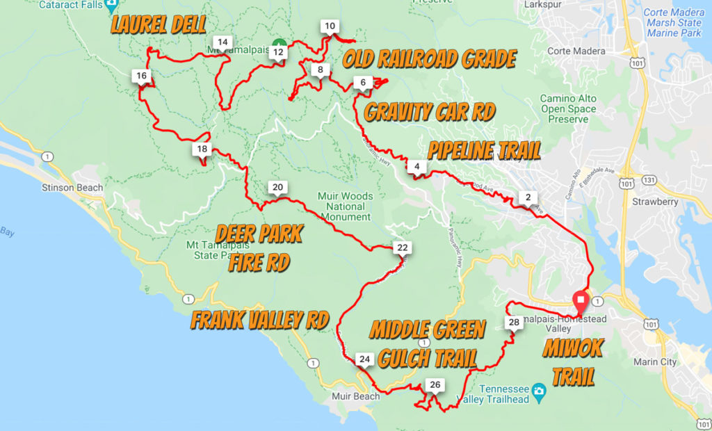
The geography is the star of this experience shaping the landscape in more ways than one.
These hillsides jutting up from the coastline creates a juxtaposition as the winds play a part of the decision where forests and grasslands reside.
At the same time, layering is an important note for cyclists to prepare for as temperatures vary from moment to moment as well as the fog.
Within all of this, that’s why the gravel is so spectacular.
To be able to navigate all this by bike and choose your own adventure gives a sense of absolute freedom, yet so close to a busy world.
I couldn’t imagine getting tired of these trails, but experiencing them even just once is a pilgrimage that will leave an imprint forever.