When you think of the Sierra, most of the time you think about the lush forests of the west like Yosemite or the large scale interplanetary landscape of the east.
The southern tip doesn’t come up in guide books as much, but really that highlights why California is so plentiful and regions get caught in the weeds.
While the closest I’ve been in the area has been around Kennedy Meadows and Johnsondale, I hadn’t really ridden off-road in the region until joining with Alejandro of CUMBRE three years ago up Rancheria Road up to Oak Flat definitely whetting my appetite from that vantage point.
When planning a route, to see more I prefer other options over an out and back, so putting together a loop here requires about a mile and a half on Highway 178, so we knocked it off first before traffic picked up headed west in the downhill direction.
Cowflat Rd wasn’t hard to spot and as expected there was a lot of vert waiting for us, but plenty of surprises built in too.
Being over a century old, the narrow width came as expected though after two and a half miles pressing us around 7%, I was shocked that the next twelve miles of dirt trended downward.
While slightly bumpy, Cowflat has obviously been regraded leaving the fun for us even the portions where rock had to be cut away.
Matching the name of this road, you will find bovines in the middle so be on the lookout as they are handy moving around the slopes.
Cowflat and the dirt ends at Breckenridge Road without much pomp and circumstance meaning you have to get yourself in climbing mode.
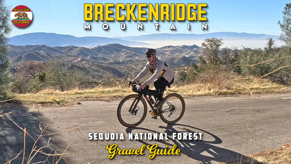
In hefty Tour de France style, it’s time to lace up for this thirteen and a half mile ascent with nearly four thousand feet of gain.
Starting out steady, the middle third is where the real work comes in averaging a consistent 8% for the next four and a half miles.
Most of the views will be to the south, but after finishing this portion the grade fluctuates between flat and steep until reaching the peak.
Because of road reconstruction (which should be fixed by now), we skipped the extra dirt to the top of Breckenridge Mountain that would have added five miles and a thousand feet of dirt.
We were eager for all this descending with nine miles left on Breckenridge Road unfortunately where the 2024 Borel Fire helps open up fantastic views to Lake Isabella and Walker Basin.
The next segment was another nine miles on Caliente Bodfish Rd that was sadly marked early by the recently burned down Civil War era town of Havilah followed by our last real climb before dropping into Bodfish for our first and last opportunity for fluids.
Finishing was simple riding back thirteen miles on Old Kern Canyon Rd that trended downward and preceded Highway 178 until the higher speed option came online in the 1970s.